Keeping rivers cool - creating riparian shade
The Secondary catchments that we will use if there is additional financial capacity in the project are: Ribble, Frome (Dorset), and Tywi (Wales). Funding has been confirmed for 2012-2013 and we will be encouraging partners to apply for Heritage Lottery match funding
Why are we undertaking this work? Because some trout and salmon populations in England and Wales are already under stress from climate change with some rivers reaching temperatures above the lethal limit for salmonids in recent hot, dry summers. It has been shown that riparian trees can help reduce local stream temperatures on hot summer days. Summer mean and maximum water temperatures are on average 2-3ºC lower in shaded versus open rivers. In certain circumstances other interventions for cooling rivers e.g. river restoration, heated effluent control, modified abstraction regimes and water meadow management may also be beneficial and we will be exploring these in the future. In the mean time we will provide riparian shade where we think it will have the greatest benefits for river ecology.
The Environment Agency will be working with charitable trusts such as the Woodland Trust and the Rivers Trusts to plant trees and put up fencing in the right areas. We are aiming for a mosaic of tree cover, rather than blanket cover which could have a negative impact on other aspects of river ecology. We will also be looking to plant trees in areas where there will be no adverse impact on the management of flood risk, water resources and other aspects of conservation at the catchment scale. All decisions about planting will be made using expert local knowledge of the area.
We have been creating guidance and tools to support on the ground work. Interim guidance on riparian shading will be available from May 2012 which will enable riparian managers and owners to follow a consistent approach to creating shade on rivers with a mixture of tree planting and fencing to promote riparian vegetation growth.
To support the identification of key areas to target to increase riparian shade we have collected LiDAR (Light Detection And Ranging) data for England and Wales and used these to produce accurate maps of riparian tree distribution, indicating where the gaps are.
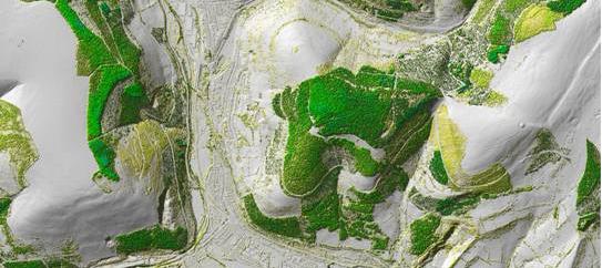
Part of a JPEG image of vegetation objects derived from LiDAR
Where the LiDAR data are available we are also developing ‘shade maps’ using models showing average incoming solar radiation within catchments. The measure of incoming solar radiation indicates the likely amount of shade created by the landscape as well as shading caused by existing vegetation. Both the tree maps and shade maps are intended as guidelines only and decisions made using these will be supported by local site information.
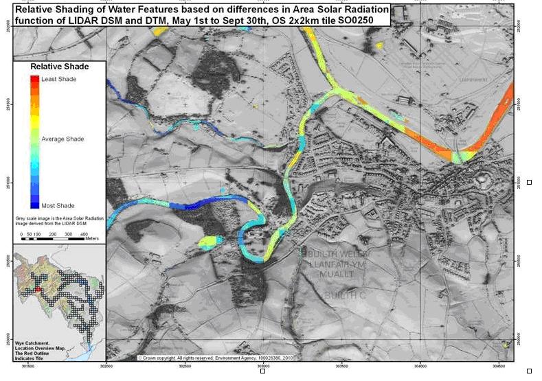
Example of a 'shade' map produced showing average incoming solar radiation presented here as relative shade within this catchment
Although there are still some knowledge gaps about the cooling effects of introducing more bank side trees we can’t ignore the risks of climate change to river conservation. We recognise that riparian shading is not a stand alone measure to managing warming in rivers, but it is a low-risk reversible action and a good start to keeping rivers cool.
13529